فَیِل:Scotland relief location map.jpg

نُمٲشِہ ہُنٛد ناپ: 456 × 600 پِکسَل باقی ریزولوشَن: 182 × 240 پِکسَل | 365 × 480 پِکسَل | 584 × 768 پِکسَل | 1٬128 × 1٬483 پِکسَل
اَصلی فَیِل (1٬128 × 1٬483 پِکسَل، فَیِل ناپ: 927 کِلوبایِٹ، MIME قسٕم:image/jpeg)
خُلاصہٕ
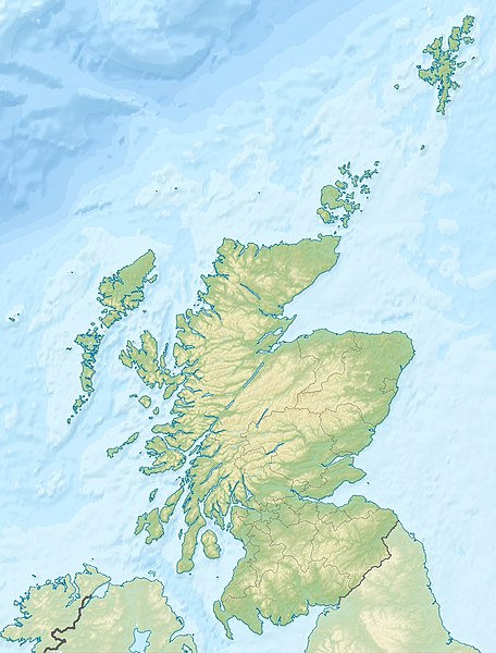
| تَفصیٖل | Quadratische Plattkarte, N-S-Streckung 170 %. Geographische Begrenzung der Karte: * N: 61.0° N * S: 54.5° N * W: 8.8° W * O: 0.4° W Equirectangular projection, N/S stretching 170 %. Geographic limits of the map: * N: 61.0° N * S: 54.5° N * W: 8.8° W * E: 0.4° W |
| تٲریٖخ | (UTC) |
| آگُر | پَنٕنؠ کأم |
| مُصَنِف |
|
| Other versions |
|

اِجازَت نامہ:
I, the copyright holder of this work, hereby publish it under the following licenses:
یَمہِ فَیِلہِ ہٕنٛز لاسَن چھِ Creative Commons Attribution-Share Alike 3.0 Unported تَحَت یِوان۔
اِنٛتِساب: Eric Gaba, NordNordWest, Uwe Dedering
- تُہۍ چھِو آزار:
- بٲغراوُن – کٲم نَقٕل، تَقسیٖم تہٕ مُنتَقٕل کَرنہٕ خٲطرٕ
- رِمِکس کَرُن – to adapt the work
- یِمَن شَرطَن تَحَت:
- اِنٛتِساب – You must give appropriate credit, provide a link to the license, and indicate if changes were made. You may do so in any reasonable manner, but not in any way that suggests the licensor endorses you or your use.
- یَکساں-شَرکٔر – If you remix, transform, or build upon the material, you must distribute your contributions under the same or compatible license as the original.

|
Permission is granted to copy, distribute and/or modify this document under the terms of the GNU Free Documentation License, Version 1.2 or any later version published by the Free Software Foundation; with no Invariant Sections, no Front-Cover Texts, and no Back-Cover Texts. A copy of the license is included in the section entitled GNU Free Documentation License. |
You may select the license of your choice.
Original upload log
This image is a derivative work of the following images:
- File:Scotland_location_map.svg licensed with Cc-by-sa-3.0, GFDL
- 2008-10-09T18:27:35Z NordNordWest 1128x1483 (829918 Bytes) {{Information |Description= {{de|Positionskarte von [[:de:Schottland|Schottland]], [[:de:Vereinigtes Königreich|Vereinigtes Königreich]]}} Quadratische Plattkarte, N-S-Streckung 170 %. Geographische Begrenzung der Karte: *
Uploaded with derivativeFX
فَیِل تَوٲریٖخ
فَیِل وُچھنہٕ باپتھ کٔریو کلک تأریخ/وقت پؠٹھ تاکہِ یہ گژھِ تمہ وقتہٕ ظٲہر
| تٲریٖخ/وَقت | تھمب نیل | پہلوٗو | صٲرِف | کَتھ | |
|---|---|---|---|---|---|
| موجودٕ | 23:30, 25 جوٗن 2010 | | 1٬128 × 1٬483 (927 کِلوبایِٹ) | Uwe Dedering | {{Information |Description={{de|Positionskarte von Schottland, Vereinigtes Königreich}} Quadratische Plattkarte, N-S-Streckung 170 %. Geographische Begrenzung der Karte: * N: 61.0° N * S: 54.5° N * W: |
فَیِلٕ ہُند اِستِعمال
یِم 2 صَفہٕ چھِ اَتھ فَیِلہِ اِستِمال کَران:
فَیِلہٕ ہُنٛد عالمِی اِستِمال
دِنہٕ آمٕتیٚو باقٕی وِکیٖیَن منٛز چھےٚ یہِ بٕہی استعمال سپدان:
- ab.wikipedia.org پؠٹھ استعمال
- am.wikipedia.org پؠٹھ استعمال
- ar.wikipedia.org پؠٹھ استعمال
- arz.wikipedia.org پؠٹھ استعمال
- ast.wikipedia.org پؠٹھ استعمال
- as.wikipedia.org پؠٹھ استعمال
- awa.wikipedia.org پؠٹھ استعمال
- azb.wikipedia.org پؠٹھ استعمال
- az.wikipedia.org پؠٹھ استعمال
- ba.wikipedia.org پؠٹھ استعمال
- be-tarask.wikipedia.org پؠٹھ استعمال
- be.wikipedia.org پؠٹھ استعمال
View more global usage of this file.