فَیِل:Nepal rel location map.svg

اَصلی فَیِل (SVG file, nominally 1٬100 × 721 pixels, file size: 1٫86 میگا بایِٹ)
خُلاصہٕ
| تَفصیٖل |
Deutsch: Positionskarte von Nepal
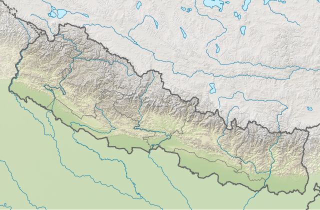
English: Location map of Nepal including the 7 provinces
|
||||||||||||
| تٲریٖخ | |||||||||||||
| آگُر |
Own work using:
|
||||||||||||
| مُصَنِف | NordNordWest | ||||||||||||
| Other versions |
|
||||||||||||


|
This map has been made or improved in the German Kartenwerkstatt (Map Lab). You can propose maps to improve as well.
|
اِجازَت نامہ:
Usage of this file with:

explanatory notes: Legally binding is only the full legalcode. For a free usage I recommend to respect the following licence conditions:
1. Provide my name as given above: NordNordWest,
2. a copy of, or the URI for, the applicable license: https://creativecommons.org/licenses/by-sa/3.0/de/legalcode,
3. the title of the work,
4. in the case of an adaptation, a credit identifying the use of the work in the adaptation.
This license and the rights granted hereunder will terminate automatically upon any breach by you of the terms of this license. Any of the above conditions can be waived if you get permission from the copyright holder. If you have questions or wish differing conditions, please contact me through nnwest or my discussion page ![]() t-online.de
t-online.de
- تُہۍ چھِو آزار:
- بٲغراوُن – کٲم نَقٕل، تَقسیٖم تہٕ مُنتَقٕل کَرنہٕ خٲطرٕ
- رِمِکس کَرُن – to adapt the work
- یِمَن شَرطَن تَحَت:
- اِنٛتِساب – You must give appropriate credit, provide a link to the license, and indicate if changes were made. You may do so in any reasonable manner, but not in any way that suggests the licensor endorses you or your use.
- یَکساں-شَرکٔر – If you remix, transform, or build upon the material, you must distribute your contributions under the same or compatible license as the original.

فَیِل تَوٲریٖخ
فَیِل وُچھنہٕ باپتھ کٔریو کلک تأریخ/وقت پؠٹھ تاکہِ یہ گژھِ تمہ وقتہٕ ظٲہر
| تٲریٖخ/وَقت | تھمب نیل | پہلوٗو | صٲرِف | کَتھ | |
|---|---|---|---|---|---|
| موجودٕ | 18:00, 2 جوٗن 2020 | | 1٬100 × 721 (1٫86 میگا بایِٹ) | NordNordWest | corr |
| 17:14, 22 مارٕچ 2020 |  | 1٬100 × 721 (1٫86 میگا بایِٹ) | NordNordWest | corr | |
| 16:51, 20 نَوَمبَر 2019 |  | 1٬100 × 721 (1٫86 میگا بایِٹ) | NordNordWest | corr | |
| 15:07, 5 جوٗن 2018 |  | 1٬100 × 721 (1٫86 میگا بایِٹ) | NordNordWest | == {{int:filedesc}} == {{Information |description= {{de|1=Positionskarte von Nepal}} {{en|1=Location map of Nepal}} {{Location map series N |stretching=114 |top=31.0 |bottom=26.0 |left=79.8 |right=88.5 }} |source={{Own using}} * United States National Imagery and Mapping Agency data * SRTM3 data |date=2018-06-05 |author={{U|NordNordWest}} |permission= |other_versions=<gallery>Nepal adm location map.svg</gallery> }} {{Kartenwerkstatt}} == {{int:license-header}} == {{User:NordNordWest/LicenceM... |
فَیِلٕ ہُند اِستِعمال
یِم 2 صَفہٕ چھِ اَتھ فَیِلہِ اِستِمال کَران:
فَیِلہٕ ہُنٛد عالمِی اِستِمال
دِنہٕ آمٕتیٚو باقٕی وِکیٖیَن منٛز چھےٚ یہِ بٕہی استعمال سپدان:
- ab.wikipedia.org پؠٹھ استعمال
- an.wikipedia.org پؠٹھ استعمال
- ar.wikipedia.org پؠٹھ استعمال
- az.wikipedia.org پؠٹھ استعمال
- ban.wikipedia.org پؠٹھ استعمال
- Évérést
- Taman Nasional Sagarmatha
- Taman Nasional Banke
- Taman Nasional Langtang
- Taman Nasional Rara
- Taman Nasional Shey Phoksundo
- Taman Nasional Khaptad
- Taman Nasional Bardiya
- Taman Nasional Makalu Barun
- Taman Nasional Shivapuri Nagarjun
- Taman Nasional Shuklaphanta
- Taman Nasional Parsa
- Lebah Kathmandu
- bcl.wikipedia.org پؠٹھ استعمال
- be.wikipedia.org پؠٹھ استعمال
View more global usage of this file.