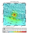
فَیِل:May 2015 Nepal earthquake ShakeMap version 3.png

نُمٲشِہ ہُنٛد ناپ: 511 × 600 پِکسَل باقی ریزولوشَن: 204 × 240 پِکسَل | 612 × 718 پِکسَل
اَصلی فَیِل (612 × 718 پِکسَل، فَیِل ناپ: 539 کِلوبایِٹ، MIME قسٕم:image/png)
فَیِل تَوٲریٖخ
فَیِل وُچھنہٕ باپتھ کٔریو کلک تأریخ/وقت پؠٹھ تاکہِ یہ گژھِ تمہ وقتہٕ ظٲہر
| تٲریٖخ/وَقت | تھمب نیل | پہلوٗو | صٲرِف | کَتھ | |
|---|---|---|---|---|---|
| موجودٕ | 20:54, 12 مٔیی 2015 |  | 612 × 718 (539 کِلوبایِٹ) | Master of Time | Version with the blank space removed |
| 20:50, 12 مٔیی 2015 |  | 612 × 792 (556 کِلوبایِٹ) | Master of Time | Directly from .ps | |
| 20:32, 12 مٔیی 2015 |  | 612 × 718 (632 کِلوبایِٹ) | Master of Time | User created page with UploadWizard |
فَیِلٕ ہُند اِستِعمال
یہِ صَفہٕ چھُ اَتھ فَیِلہِ اِستِمال کَران:
فَیِلہٕ ہُنٛد عالمِی اِستِمال
دِنہٕ آمٕتیٚو باقٕی وِکیٖیَن منٛز چھےٚ یہِ بٕہی استعمال سپدان:
- en.wikipedia.org پؠٹھ استعمال
- my.wikipedia.org پؠٹھ استعمال
- nl.wikipedia.org پؠٹھ استعمال
- zh.wikipedia.org پؠٹھ استعمال
