فَیِل:Croatia location map.svg

Size of this PNG preview of this SVG file: 619 × 599 پِکسَل. باقی ریزولوشَن: 248 × 240 پِکسَل | 496 × 480 پِکسَل | 793 × 768 پِکسَل | 1٬058 × 1٬024 پِکسَل | 2٬116 × 2٬048 پِکسَل | 1٬097 × 1٬062 پِکسَل
اَصلی فَیِل (SVG file, nominally 1٬097 × 1٬062 pixels, file size: 480 کِلوبایِٹ)
خُلاصہٕ
| تَفصیٖل |
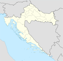
Deutsch: Positionskarte von Kroatien
Quadratische Plattkarte, N-S-Streckung 140 %. Geographische Begrenzung der Karte:
English: Location map of Croatia
Equirectangular projection, N/S stretching 140 %. Geographic limits of the map:
|
| تٲریٖخ | |
| آگُر | own work, using United States National Imagery and Mapping Agency data |
| مُصَنِف | NordNordWest |
| Other versions |
Derivative works of this file: |

|
This map has been made or improved in the German Kartenwerkstatt (Map Lab). You can propose maps to improve as well.
|
اِجازَت نامہ:
I, the copyright holder of this work, hereby publish it under the following licenses:

|
Permission is granted to copy, distribute and/or modify this document under the terms of the GNU Free Documentation License, Version 1.2 or any later version published by the Free Software Foundation; with no Invariant Sections, no Front-Cover Texts, and no Back-Cover Texts. A copy of the license is included in the section entitled GNU Free Documentation License. |
یَمہِ فَیِلہِ ہٕنٛز لاسَن چھِ Creative Commons Attribution-Share Alike 3.0 Unported تَحَت یِوان۔
- تُہۍ چھِو آزار:
- بٲغراوُن – کٲم نَقٕل، تَقسیٖم تہٕ مُنتَقٕل کَرنہٕ خٲطرٕ
- رِمِکس کَرُن – to adapt the work
- یِمَن شَرطَن تَحَت:
- اِنٛتِساب – You must give appropriate credit, provide a link to the license, and indicate if changes were made. You may do so in any reasonable manner, but not in any way that suggests the licensor endorses you or your use.
- یَکساں-شَرکٔر – If you remix, transform, or build upon the material, you must distribute your contributions under the same or compatible license as the original.
You may select the license of your choice.
فَیِل تَوٲریٖخ
فَیِل وُچھنہٕ باپتھ کٔریو کلک تأریخ/وقت پؠٹھ تاکہِ یہ گژھِ تمہ وقتہٕ ظٲہر
| تٲریٖخ/وَقت | تھمب نیل | پہلوٗو | صٲرِف | کَتھ | |
|---|---|---|---|---|---|
| موجودٕ | 08:00, 29 اَگَست 2008 | | 1٬097 × 1٬062 (480 کِلوبایِٹ) | NordNordWest | |
| 15:54, 30 جُلَے 2008 |  | 548 × 531 (412 کِلوبایِٹ) | NordNordWest | more detailed borderlines | |
| 16:55, 16 جُلَے 2008 |  | 548 × 531 (454 کِلوبایِٹ) | NordNordWest | {{Information |Description= {{de|Positionskarte von Kroatien}} Quadratische Plattkarte, N-S-Streckung 140 %. Geographische Begrenzung der Karte: * N: 46.8° N * S: 42.1° N * W: 13.1° O * O: 19.9° O {{en|Location map of [[:en:Croatia|Cr |
فَیِلٕ ہُند اِستِعمال
یِم 2 صَفہٕ چھِ اَتھ فَیِلہِ اِستِمال کَران:
فَیِلہٕ ہُنٛد عالمِی اِستِمال
دِنہٕ آمٕتیٚو باقٕی وِکیٖیَن منٛز چھےٚ یہِ بٕہی استعمال سپدان:
- ab.wikipedia.org پؠٹھ استعمال
- af.wikipedia.org پؠٹھ استعمال
- als.wikipedia.org پؠٹھ استعمال
- am.wikipedia.org پؠٹھ استعمال
- an.wikipedia.org پؠٹھ استعمال
- ar.wikipedia.org پؠٹھ استعمال
- قالب:خريطة مواقع
- قالب:خريطة مواقع كرواتيا
- قالب:خريطة مواقع/شرح
- بطولة أوروبا لكرة الصالات 2012
- قالب:خريطة مواقع/ملعب
- قالب:Location map/sandbox quick/doc
- وحدة:Location map/data/Croatia
- وحدة:Location map/data/Croatia/شرح
- اشتباك باكراتش
- حادثة بحيرات بليتفيتش
- معركة بوروفو سيلو
- حصار كييفو (1991)
- عملية العاصفة (حرب البوسنة والهرسك)
- arz.wikipedia.org پؠٹھ استعمال
- ast.wikipedia.org پؠٹھ استعمال
View more global usage of this file.